

Storm Team 2 tracking severe weather threat for Saturday morning
CHARLESTON, S.C. (WCBD) – Storm Team 2 is tracking a threat for severe storms ahead of a powerful cold front that will pass through the region Friday into early Saturday morning.
“Wind damage will be the greatest concern, but an isolated tornado isn’t out of the question,” said Storm Team 2 Meteorologist Josh Marthers.
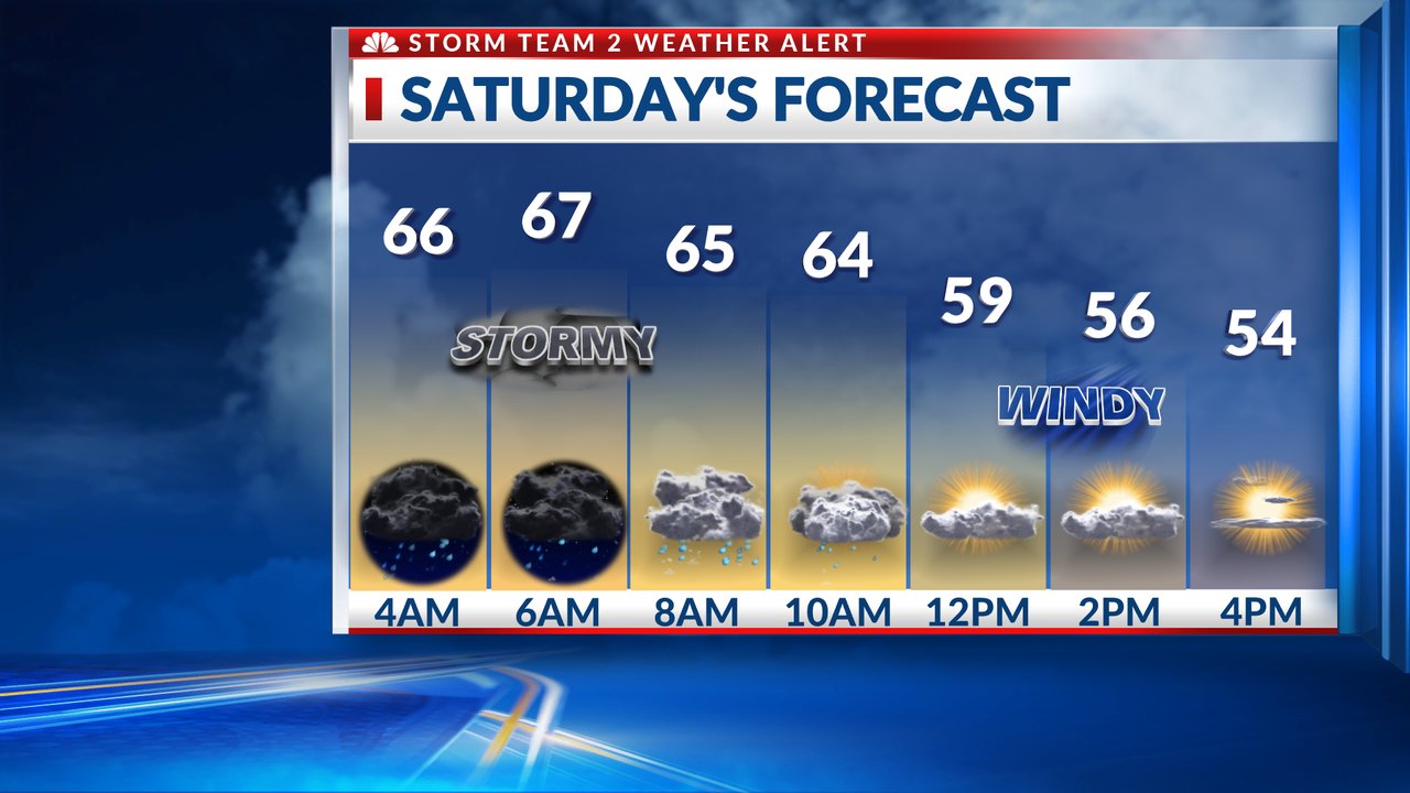
Rain chances will increase Friday through Saturday morning. Marthers said there is a risk for severe storms along the cold front that could fire up on either side of daybreak Saturday.
Wind gusts will be around 30 mph ahead of the cold front as it moves in.
The timing is between 4:00 a.m. and 10:00 a.m.
Again, the greatest threat is wind damage. “Even outside of showers and thunderstorms, we’re going to have frequent wind gusts of 40 mph, and there could be 50 or 60 mph gusts at times,” said Marthers.
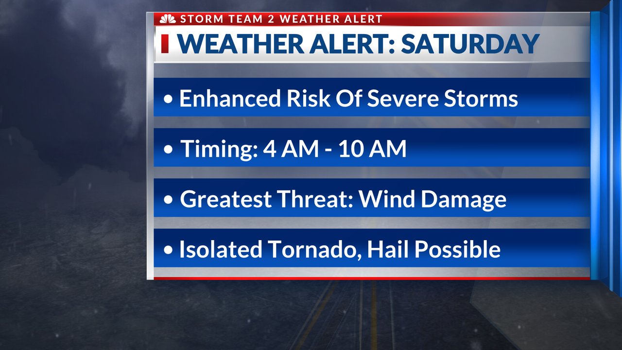
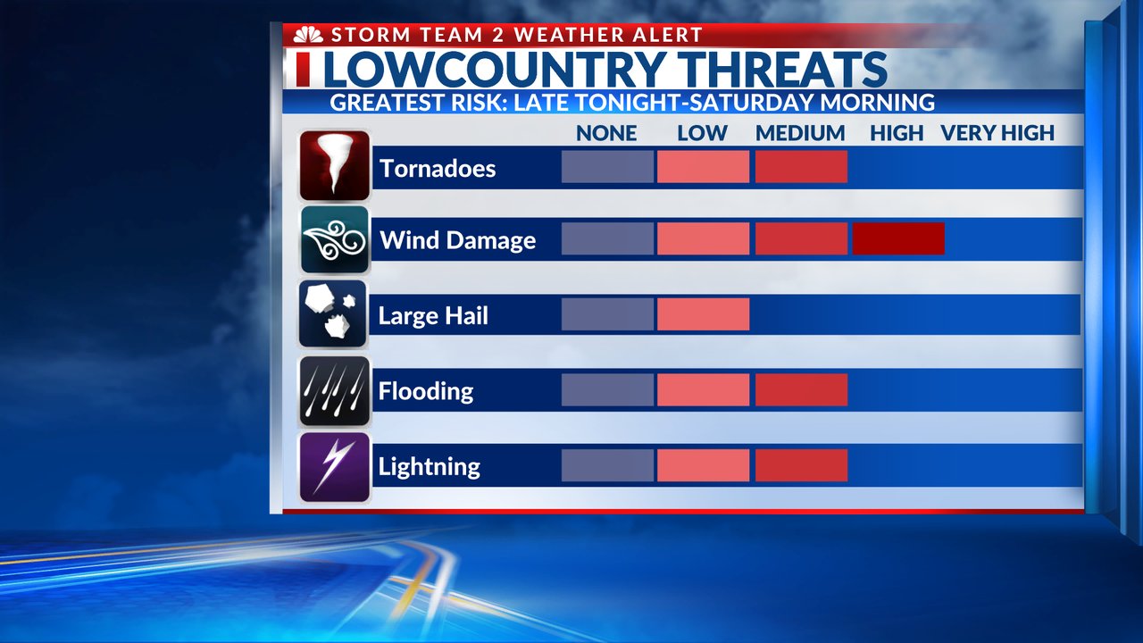
An isolated tornado and hail along the squall line are possible as it moves through.
Once it clears the coast, the sky will clear quickly but things will remain gusty. Temperatures will drop from highs in the mid-60s to near 70 in the morning and then in the 50s for the late afternoon with gusty winds up to 40 mph driving that colder air to the coastline.
DOWNLOAD THE STORM TEAM 2 WEATHER APP
APPLE USERS CLICK HERE | ANDROID USERS CLICK HERE